It's National Wilderness Month - That's something to celebrate!
Blog by Emily Pierce, PLS CFedS
I actually didn’t know that September is National Wilderness Month, but I love the outdoors, though some of the wilderness I’ve experienced has been a bit too real.

Surprise, Emily! Here I am!
A few years ago I was working on a PLSS remonumentation project in a remote location in Rusk County, Wisconsin. That morning, while setting up my GPS base station, a couple stopped by asking what I was up to and warned be about a bear in the area that was potentially record-breaking size. Needless to say, I went about my day not thinking too much of it. Later, I was trying to navigate through a tag alder swamp with a stake bag full of rebar, a heavy maul, and stakes, along with my GPS rover, squeezing around and through the tightly wound alder branches, when I heard a low rumble . . . and yes, the bear I spotted was definitely a record-breaker! It must have been more than 700 pounds. I was hoping he wasn’t a bone-breaker as well, as I began to shout to scare it off. Fortunately that worked - a saw a flash of black fur as it took off running, breaking every branch in its path. It was terrifying to be less than 30 feet away from a bear in it’s own habitat with nothing for protection except quick thinking.
Walking in the wilderness alone can be very peaceful and serene, but after that experience, I started carrying bear spray with me just in case. We want to be able to enjoy all that the wilderness has to offer, but we should be aware of our surroundings and enjoy it all while taking safety precautions as well, especially if traveling alone.
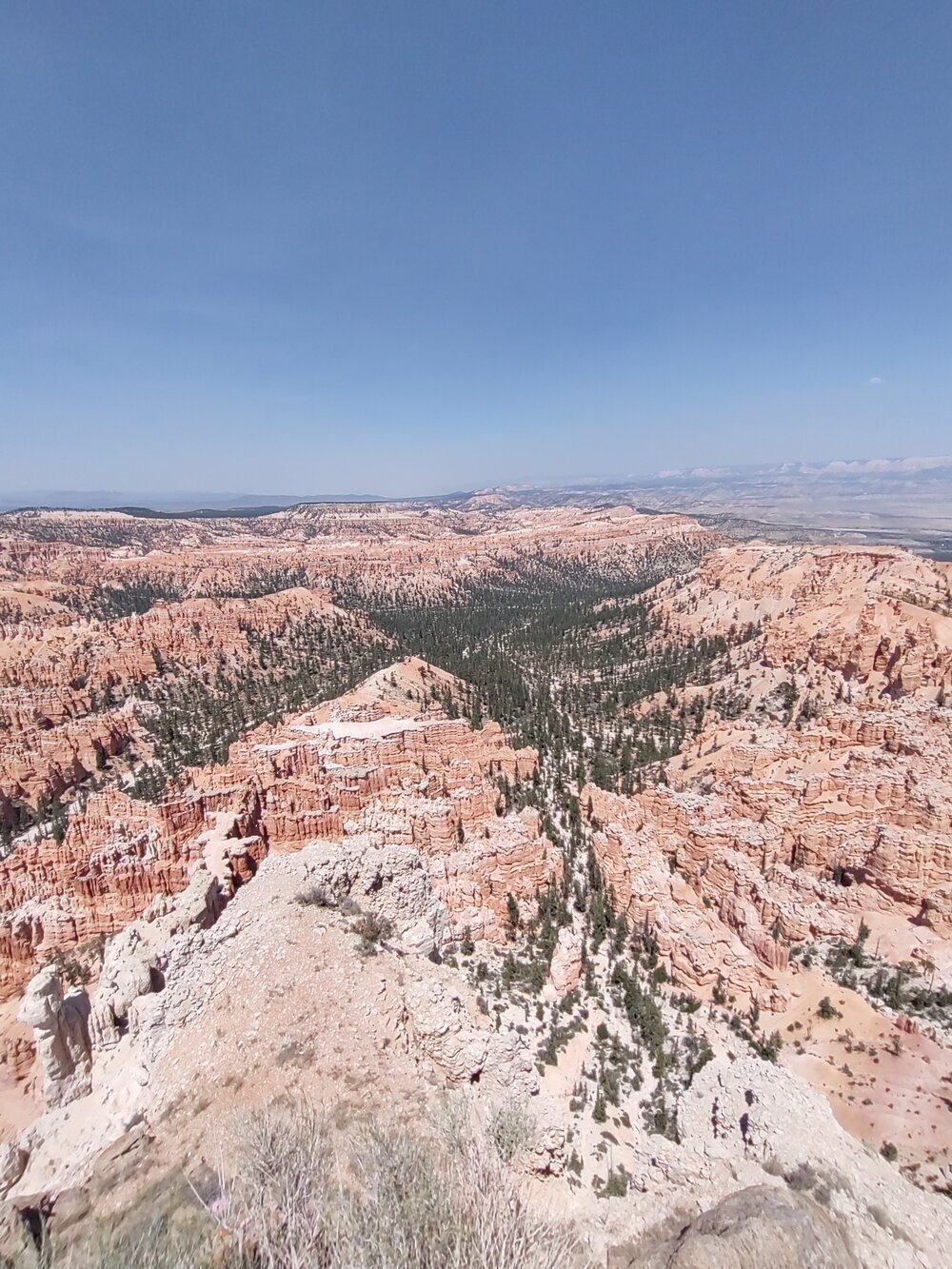
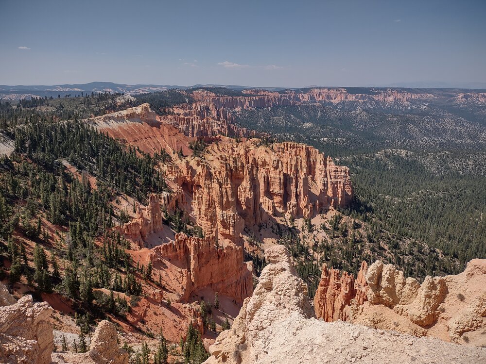
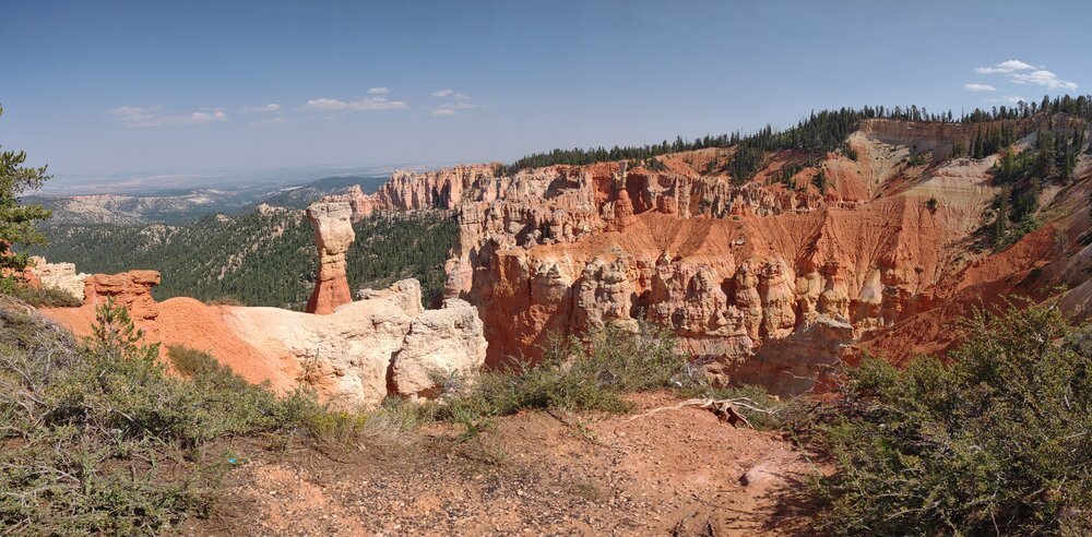
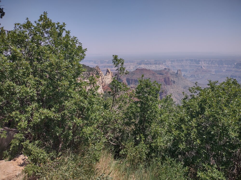
All this leads me to the last National Park blog from my recent vacation. Everything was so amazing, but I think we saved the best for last – the North Rim of the Grand Canyon.
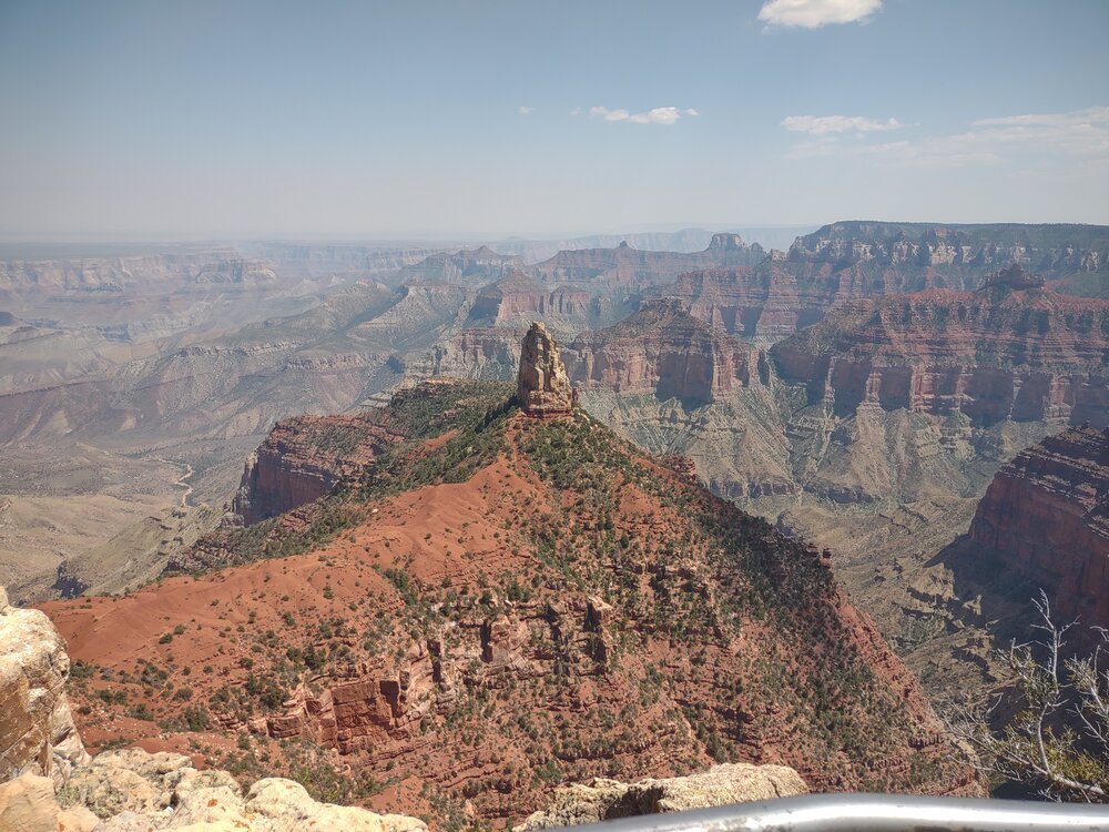
The North Rim

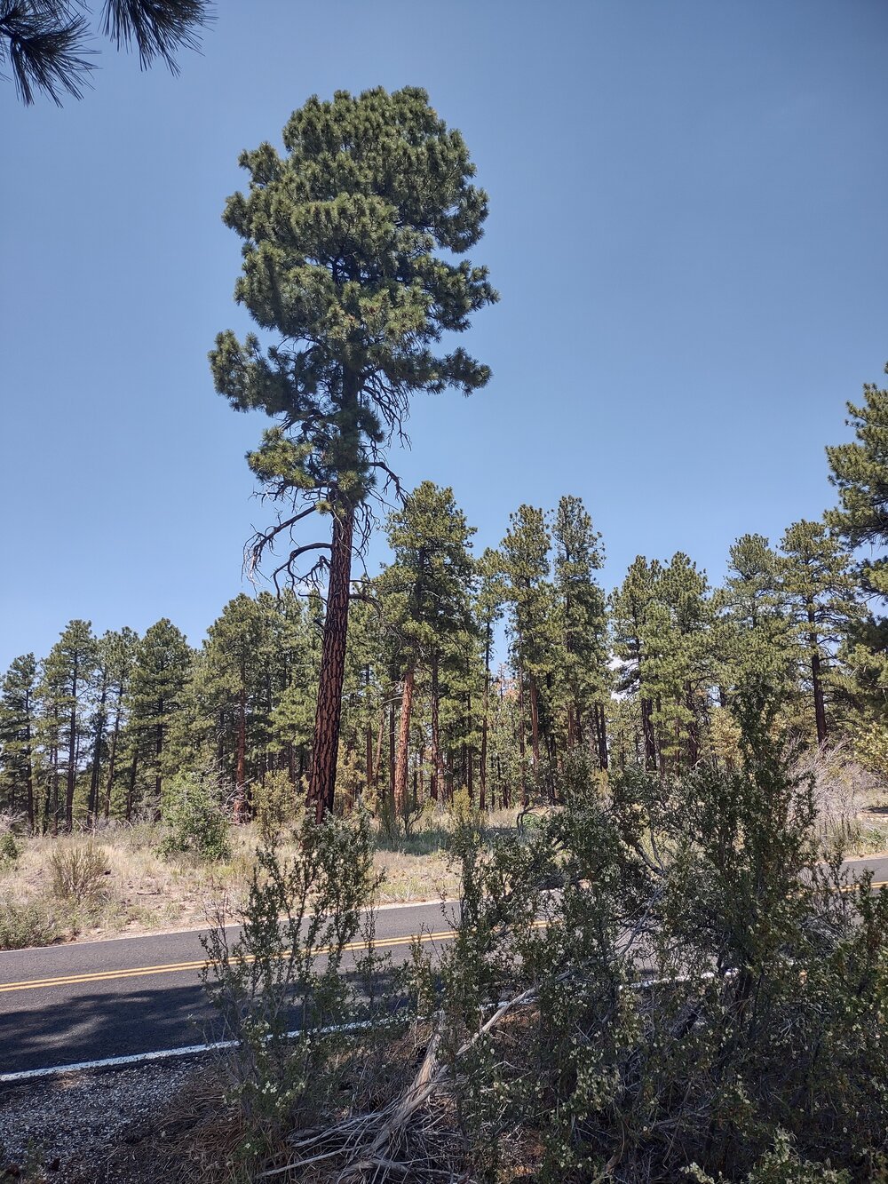
The Kaibab National Forest (Arizona) as viewed from my car. Looks like Wisconsin!
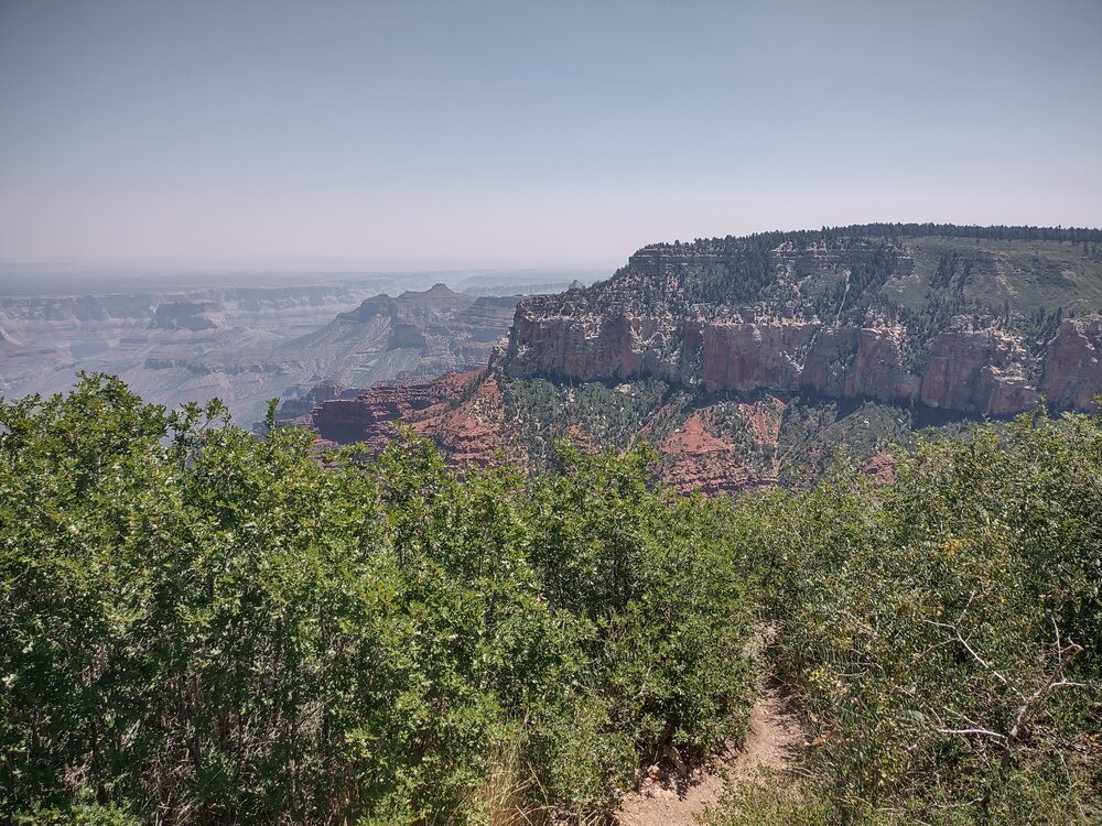
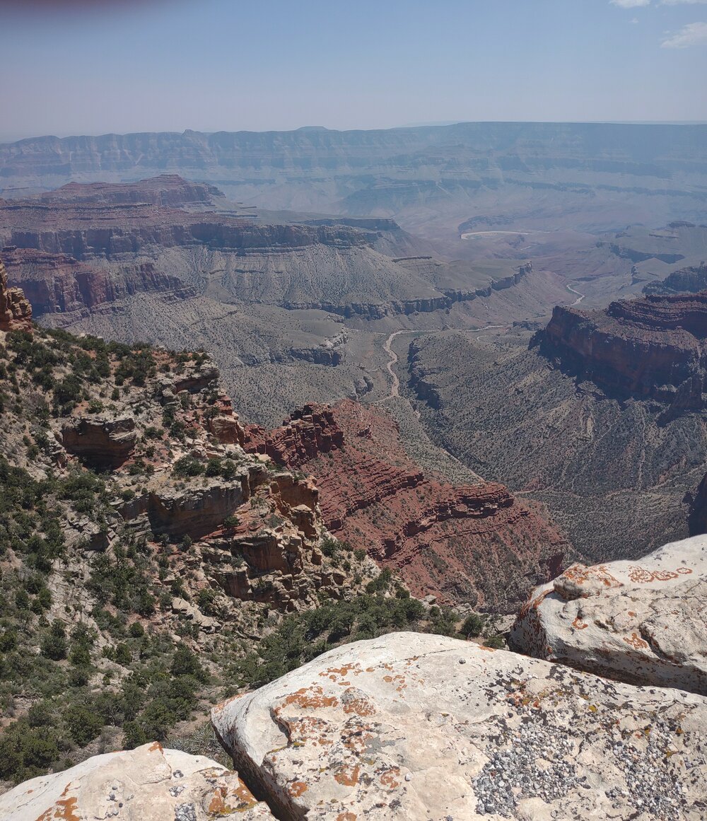
It’s one of the lesser-visited locations, because most people visit the South Rim, coming in from Phoenix or Flagstaff. The South Rim has all the amenities you’d expect at one of the most famous natural landmarks in the world. The North Rim is a bit more off the beaten path with fewer ameneties; no McDonald’s or Starbucks like the South Rim, but the views are just as stunning . . .and on a good day, you can see 10 miles across the canyon from the North to the South Rim.
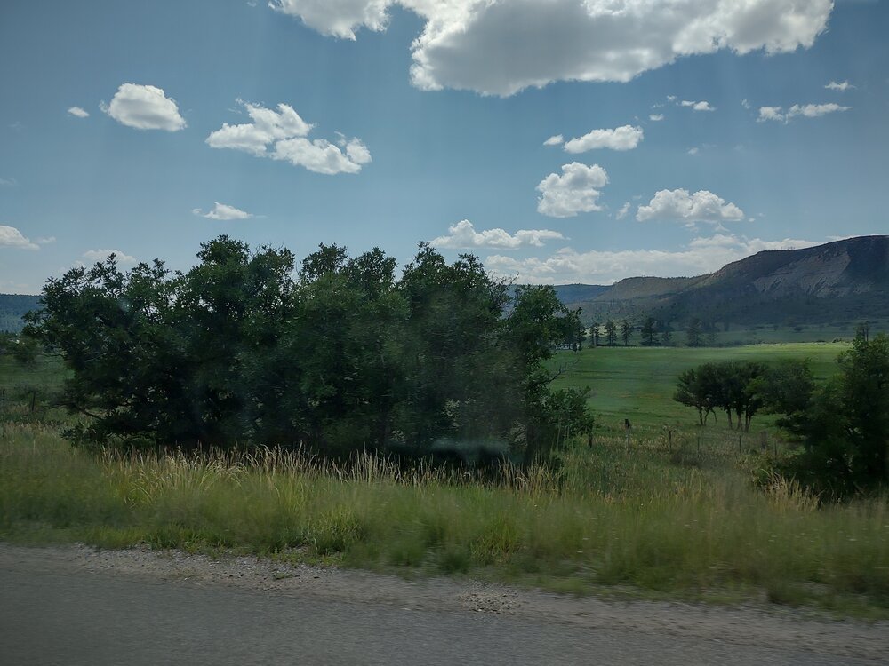
We came in through the Kaibab National Forest . . . and, shocker, it was a real forest! Towering Ponderosa pine, aspen and lush green grass greeted us -- not the cacti, sage and agave that we expected. I felt I was back in northern Wisconsin, with its towering pine trees and green meadows. I learned that Ponderosa pine only grow up to an elevation of 9,000 feet, and beyond that, we saw Utah juniper, cottonwood and bristlecone pine.

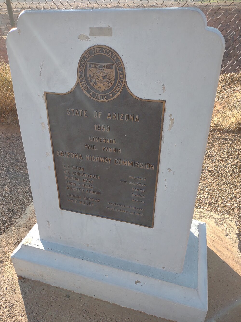
What is this marker about? If you know, email me at email@berntsen.com, and I’ll add it to the blog.
Mystery Marker
At the entrance to the Grand Canyon National Park, I spotted some markers right by the sign. The first monument was a typical ROW marker – the other one was from Denver, Colorado – I have no idea why it was there! If you know, send me an email and I’ll add it to the blog.
We took a walk to get to Bright Angel Point (Elevation 8161), our first stop in the Grand Canyon. The quarter-mile walk took us along a paved, narrow trail along a ridge with deep ravines dropping 3,500 - 5,000 feet straight down. Not everyone in my family was brave enough to cross that narrow ridge to see the breathtaking view at the end. But it was well worth the terror.
Brighty, the Lucky Burro
Then we visited the Wylie Way Lodge and met the bronze version of Brighty. The real Brighty was a wild burro who lived in the Canyon from 1882 to 1922. Burros (Spanish for donkey) were brought to the Americas in the 1500s by the Spanish. By the late 1800s, prospectors were using them as beasts of burden in the Grand Canyon area. When the mother loade of gold (or copper, lead or asbestos) failed to materialize, the prospectors simply abandoned their equipment and their burros . . . leading to a booming population of feral burros.

Shrine to Brighty, the very lucky Grand Canyon Burro.
Brighty was first spotted in about 1917 near an abandoned miner’s tent, sitting as if he was expecting the tent’s occupant to return. He was befriended by Bob McKee, the son of the couple who managed the first tourist facility on the North Rim. Brighty spent his life as he wished – occasionally hauling water up from the Canyon floor for little Bob (the hotel didn’t have its own water then – it all had to be hauled up from the Colorado River). Brighty came and left as he wished, and if a hunter caught Brighty and tried to make him haul his gear, Brighty would sneak away, rubbing the pack against trees until the load fell off.
Brighty truly lived a charmed life – shortly after his passing, the park service decided to remove the wild/semi-domesticated burros. Rangers began hunting burros – between 1294 and 1931, 1,467 burros were killed . . .the killing continued at a slower pace despite the publication of a very popular book in 1953 by Marguerite Henry about Brighty: “Brighty of the Grand Canyon.” Later, in the early 1960’s a movie was made of the book, and the producers had a 600 pound bronze statue of Brighty created to promote the movie. The statue was donated to the museum, and it became a very popular exhibit that also caused the public to ask why burros were still being killed. The short answer is that the park service is mandated to protect native ecosystems from invasive species, so they took care of it the cheapest way possible. However, there was so much public outcry that in 1967, 577 burros were airlifted out and adopted to waiting families. Today, you can only find a handful of domesticated burros in the Grand Canyon – along with the statue of Brighty.
Movin’ On
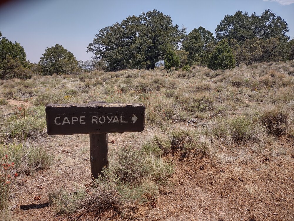
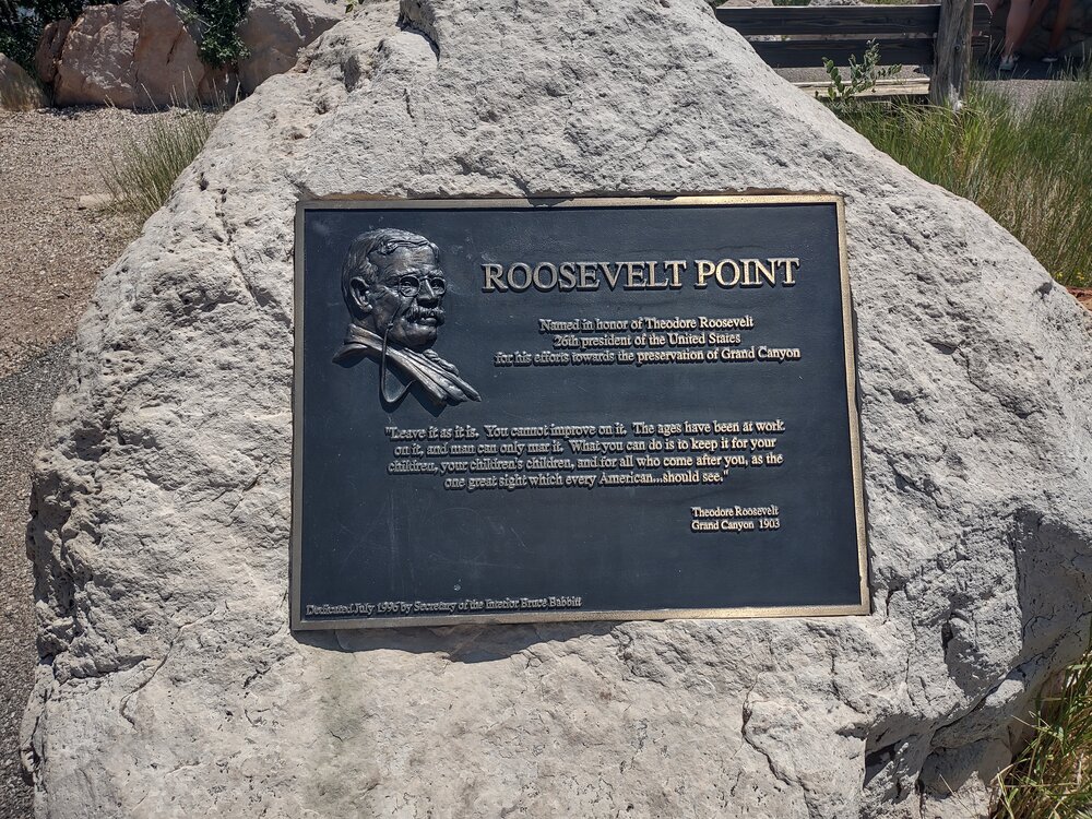
After paying our respects to Brighty, we drove out to Cape Royale, just 23 miles away – but it took 45 minutes due to the mountainous (scary) road. We saw Roosevelt Point, named after the junior surveyor (and President) Teddy Roosevelt to commemorate his work that helped create the Grand Canyon National Park.
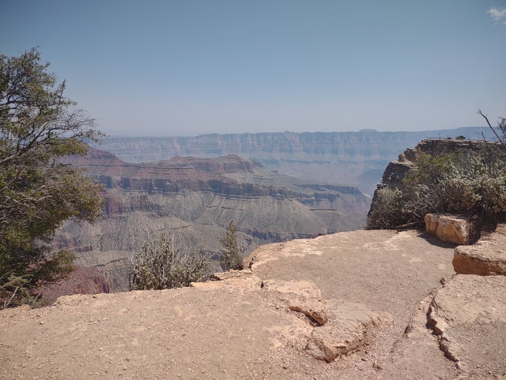
Cape Royale had two lookouts – Angel’s Window, and Cape Royale – breathtaking!
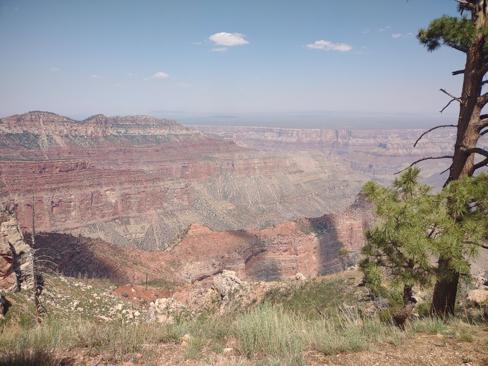
Next, it was Point Imperial, the highest point on the north rim (8803). Being in the Grand Canyon is like entering a whole different planet. All you can see is the forest and this massive, stunning, canyon. I had this sense of how small we are compared to the world around us. You can’t be in this place and not be awestruck by the massive, magnificent scene. Then you drive out and it’s back to the regular world.

Low water levels in Lake Powell
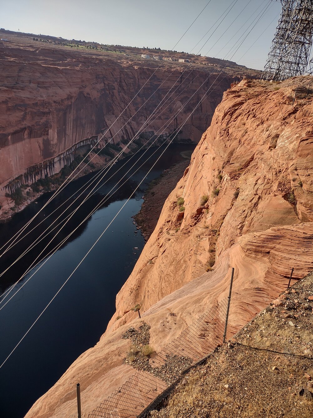
The next morning, we left our little cabin in Kanab, Utah that we called home for five days, crossed the Colorado River, and saw the critically low water levels in Lake Powell. I toured the Hoover Dam a few years ago and learned the importance of the Colorado River source. Forty million Americans rely on this as a water source for drinking water and crop irrigation. In addition, a lot of The Colorado’s water is also promised to farmers south of the border in Mexicali, as part of a treaty the U.S. signed with Mexico in 1944. It is also critical for wildlife to survive in the river’s delta at the Gulf of Baja California. Lake Powell water level is currently 150 feet low and is only holding about 31% of its full pool. It’s taken many years to get this low, but even then, it’s 51 feet lower than just a year ago. This is being caused by a “megadrought” that’s lasted nearly 20 years, as well as reductions in snow caps feeding the Colorado River and its tributaries.
Additionally, with water consumption increasing, this puts the energy production produced by the Hoover Dam and the Glen Canyon Dam at risk. It was incredibly disheartening to see the critical water levels and even more disheartening to comprehend the impact those levels have on people.
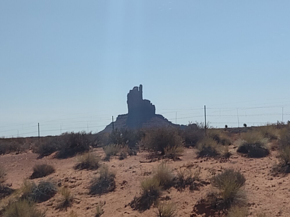
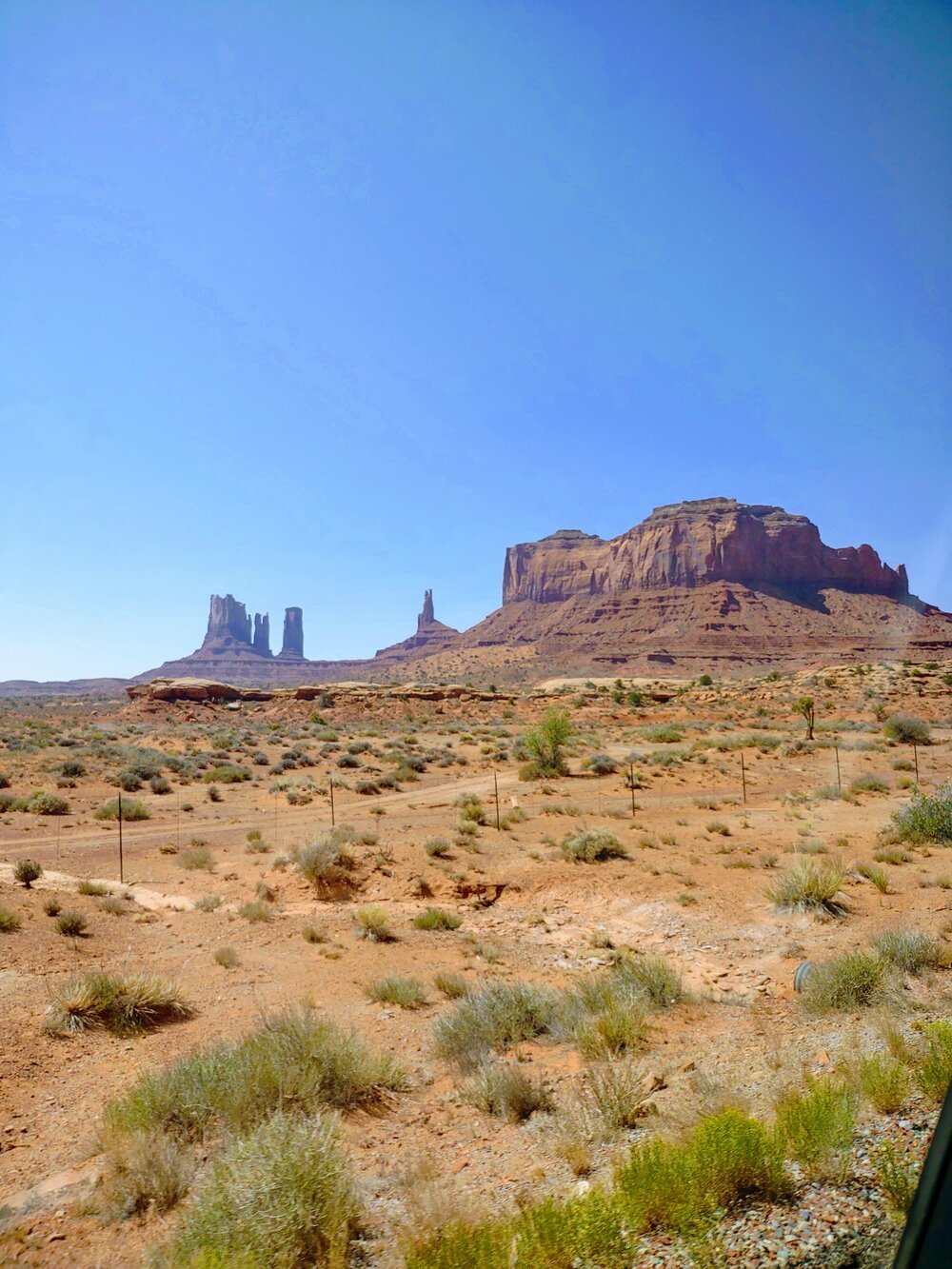
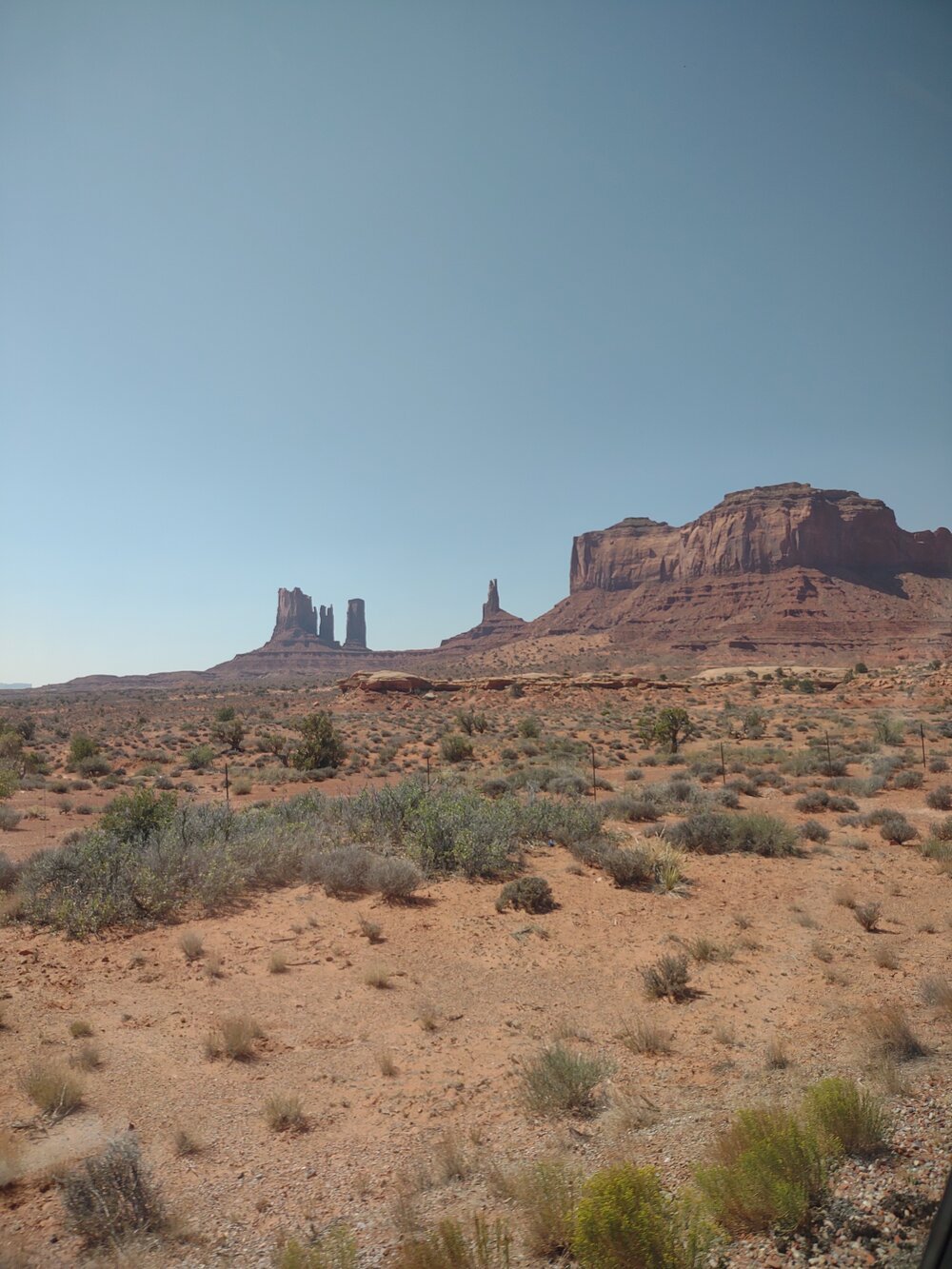
Monument Valley

Monument Valley
After Lake Powell, we moved on to Monument Valley! I felt like I’d already been there because it’s been in so many movies. It’s actually a Navajo Nation Park (that spans both Utah and Arizona), and I think our timing was perfect, as we hit the time right between closures due to the pandemic.
But how were these monuments created? According to the Navajo Nation website, the Park was once a lowland basin surrounded by the Rock mountains. Year after year, these mountains eroded, depositing sediment, turning the basin into a plateau. For another 50 million years or so, wind and water eroded the surface of that plateau, leaving behind the monuments we see today.
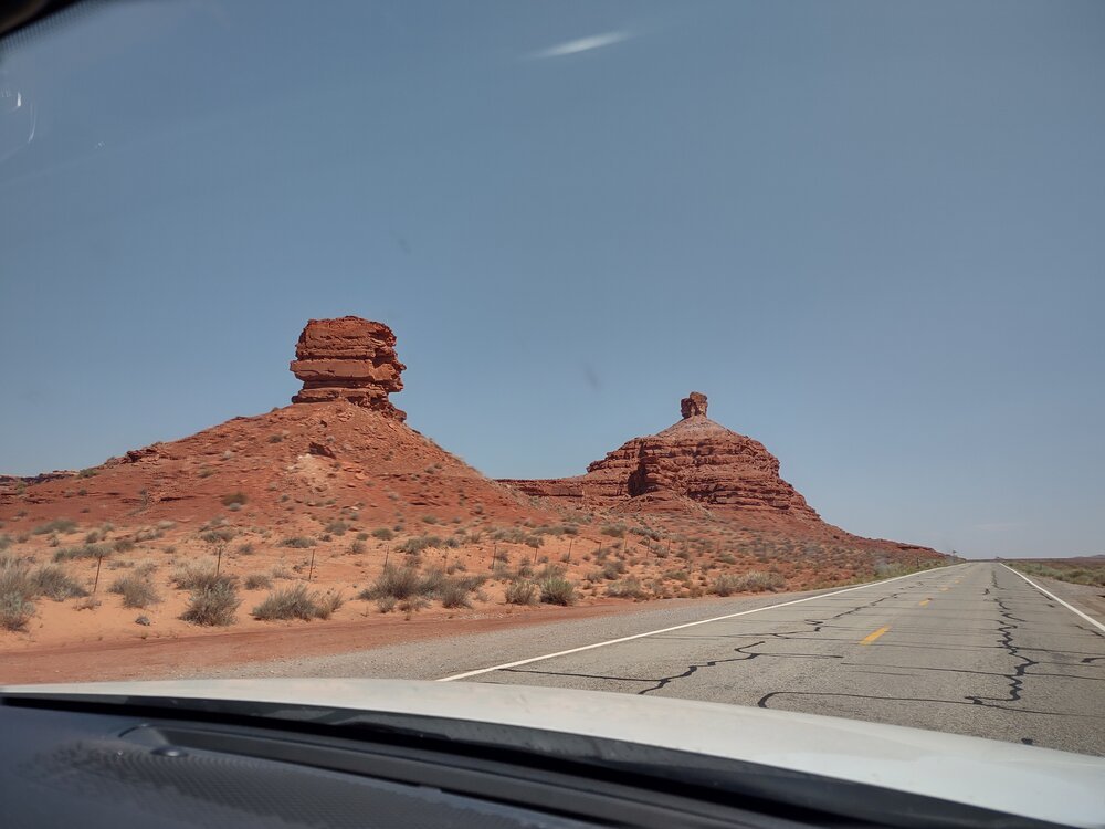
But more importantly, my daughters got to re-create that famous “Forrest Gump” moment when he decides to turn around, right in Monument Valley. But we didn’t turn around, we continued on . . . while my daughters kept looking for “Radiator Springs” (the town from the ‘Cars’ movie”). We didn’t find it but the scenery around us looked like the inspiration, and I think Mexican Hat, a small town in Utah, could have easily been mistaken for it
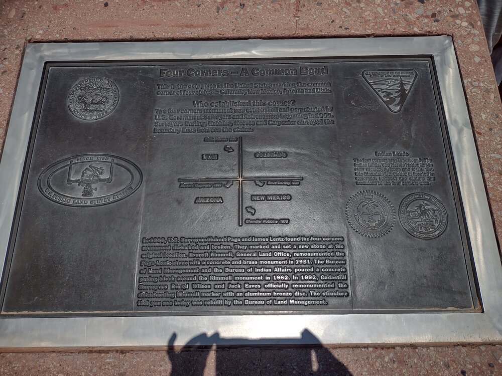
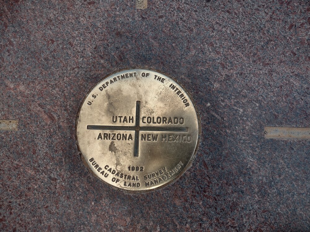
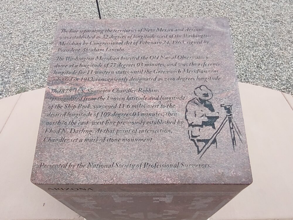
Then on to Four Corners. My daughters enjoyed “leaving the state without permission” by hopping across the state lines. We had a little fun with that, even posing for our picture with each one of us standing in a different state. The National Society of Land Surveyors (NSPS) has done an amazing job providing granite tablets along each boundary noting portions of the language from the state line descriptions. As a surveyor, I found it quite interesting to read each excerpt.

The Four Corners was first established in 1868 by the surveyors Darling, Robbins, Reeves and Carpenter of the US Government Surveyors and Astronomers. In 1899, the surveyors Hubert Page and James Lentz found the four corners monument disturbed and broken. They marked and set a new stone at the original location. Everett Kimmell, General Land Office, remonumented the Page-Lentz stone with a concrete and brass monument in 1931. The BLM and the BIA poured a concrete paving block around the Kimmell monument in 1962. In 1992, Cadastral Surveyors Darryl Wilson and Jack Eaves officially remonmented the deteriorating Kimmell marker with an aluminum bronze disc from Berntsen International. We have an interesting blog about that here.
You can get a replica of that monument here.
Then, it was on to Durango and through the Colorado Rockies! Driving through Wolf Creek Pass, el. 10,857’, was a bit white knuckle, but the views were spectacular. We ended up in Fairplay, Colorado for the night. then back to Tomahawk Wisconsin – home sweet home!
It always feels so satisfying to get home, but my adventures to the Southwest will always be remembered. The timing was perfect as my older daughter will be preparing for college next year and that will bring a whole different adventure to the Pierce family.