News and Events
Archive
- April 2025
- March 2025
- February 2025
- January 2025
- December 2024
- November 2024
- September 2024
- August 2024
- July 2024
- June 2024
- May 2024
- April 2024
- March 2024
- February 2024
- January 2024
- December 2023
- November 2023
- October 2023
- September 2023
- August 2023
- July 2023
- June 2023
- May 2023
- April 2023
- March 2023
- February 2023
- January 2023
- December 2022
- October 2022
- August 2022
- July 2022
- June 2022
- May 2022
- April 2022
- March 2022
- February 2022
- January 2022
- December 2021
- November 2021
- October 2021
- September 2021
- August 2021
- July 2021
- June 2021
- May 2021
- April 2021
- March 2021
- February 2021
- January 2021
- December 2020
- November 2020
- October 2020
- September 2020
- August 2020
- July 2020
- June 2020
- May 2020
- April 2020
- March 2020
- February 2020
- January 2020
- December 2019
- November 2019
- October 2018
Celebrating GIS - the technology that keeps on giving
GIS was first developed in 1963 by Roger Tomlinson who used computers to handle map information for the Canadian government. Since that time, the use of Geographic Information System technology has exploded. According to MarketsandMarkets, the GIS market is expected to reach $14.5 billion by 2025. By 2032, the market is projected to reach about $43.8 billion.
Disaster response and resilience
A recent survey revealed that many people believe that natural disasters are more frequent and severe than in the past. It turns out that this observation is backed up by facts. According to the National Oceanic and Atmospheric Administration (NOAA), the frequency of natural disasters is increasing year-over-year. There were 28 weather and climate disasters in 2023, surpassing the previous record of 22 in 2020, tallying a price tag of at least $92.9 billion.
Key Trends in 2024
The “Fourth Industrial Revolution” is well underway. Back in 2011, economist Klaus Schwab coined the term to refer to the rapid digitization and accessibility of technologies that spark a global shift in processes – in everything from how we communicate to how businesses and governments are managed.
It’s National 811 Day
811 Day was created to bring attention to a significant but unfamiliar issue – the high cost and safety impacts of underground utility strikes.
Quantifying the cost and safety impacts of utility strikes is difficult. A compilation of various studies estimates that the direct cost of each strike is $4,000 -- but that doesn’t take into consideration the cost to repair and restore the damage. Taken together, the cost of the strike plus the cost of restoration, the total is 29 times the cost of the direct damage itself.
RFID + GIS = SUE Enhancement
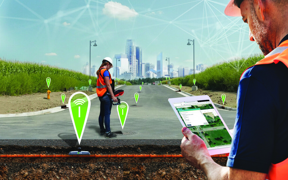
Subsurface Utility Engineering (SUE) that leverages Geographic Information Systems (GIS) and Radio Frequency Identification (RFID) deliver substantial benefits in the management and protection of underground assets.
RFID - technology that keeps on giving
We’ve all heard of RFID, a technology that’s been around since the 1930s. Did you know that it’s now one of the fastest-growing technologies in the world?
Marking and Mapping - Two-factor Verification for Underground Locating
It’s spring and construction is booming . . . hopefully with fewer actual “booms”, caused by utility strikes. Safe digging is something that’s near and dear to surveyors and any profession that involves excavation. As I mentioned in my last blog, preventable utility strikes cost at least $60 billion annually, not to mention the loss of life and life-altering injuries that can occur.
It’s National Engineers Week!
Most engineers would argue that it’s always engineers week, but this week is the “official” week to highlight the stunning array of engineering accomplishments and types of engineering that make our lives easier in every way.
Blossoming Blooms
Harmful algae blooms (HABs) are occurring more and more frequently in lakes, rivers, streams and coastal areas across the United States. Further, HABs are occurring where they were never found in the past. View a map from the Natural Resources Defense Council that tracks HABs across the United States.
Today is GIS Day!
Most people don’t really think about how geographic information provides the framework for our entire existence. We exist as living organisms in time and space. Our minds may be occupied with far-way thoughts, but our memories are inextricably tied to the place where they were created. As long as we live and breathe, we always have a location. Shakespeare’s Hamlet said “To be or not to be, that is the question.” Surveyors say, “To be is to occupy a position relative to two axes.”
It's World Creativity and Innovation Day
The United Nations passed a resolution creating this day to celebrate the creative economy, which actually makes a lot of sense, considering the entire world is just beginning to come out of a pandemic that really forced us all to get creative just to do our jobs.
Fortunately, surveyors have made creativity a way of life. It seems like we have a pretty straightforward job – use our tools to verify property lines, monitor structures for movement over time, lay out the lines for construction, etc.
GIS Day is November 18
Little did I know that dusty old geography would become the one of the most interesting (and explosively-growing) fields in science. Today Geographic Information Systems (GIS) is shaking up the world of geography – and statistics, data analysis, spatial data, modeling, geostatistics, cartography, data integration, GPS – and on and on.


