The Four Great Surveys and Our National Parks
July is National Parks and Recreation Month, and the Fourth of July weekend is one of the busiest times of year at our national parks. This year when more than 325 million people are expected to visit the 400 national parks throughout the United States.

Image from the Report of the Geological Exploration of the Fortieth Parallel by Clarence King, 1878, page iii. “Na~ura~ Column, Washakie Bad-Lands” by Julius Bien, chromolithographs after studies by Gilbert Manger, plates in black after photographs by T. H. O'Sullivan.
Did you know that surveyors played a key role in creating our national parks? Our first park, Yellowstone (founded 1872), introduced the national park concept to the public and other parks soon followed – all this when most people still lived east of the Mississippi and most would not have the opportunity to see these natural wonders in person.
The public learned about the natural beauty of the American West mainly from survey expeditions – beginning with the Lewis & Clark expedition in 1804 to 1806, then later from four great surveys commissioned by Congress in 1867 to explore the geology and mineral wealth west of the Mississippi.
The four great surveys were:
The U.S. Geological Exploration of the 40th Parallel, led by Clarence King (1867-78)
the U.S. Geographical Survey West of the 100th Meridian, led by Lieutenant George Montague Wheeler; (1872-79)
the U.S. Geological and Geographical Survey of the Territories, led by Ferdinand Vandeveer Hayden (1867-78)
the U.S. Geographical and Geological Survey of the Rocky Mountain Region, led by John Wesley Powell (1869-79)
The Survey of the 40th Parallel

King Clarence, three-quarter-length portrait, seated "at age of 27". Retrieved from the Library of Congress.
Born to a wealthy, well-established family in Newport, Rhode Island in 1842, Clarence King was raised by his mother after his father died in 1848. King was a good student, eventually graduating from Yale with a B.S. in Chemistry.
He was an enthusiastic student of both books and nature. “His observations of natural objects, plants, animals, or rocks were so vivid that they seemed to photograph themselves upon his memory, so that he could recall the picture at will. He wrote readily and with delicate literary judgment and skill, thanks to the influence of his mother's teaching. His love of outdoor life had so developed a naturally robust physique that he readily excelled in all athletic sports, especially rowing”[1].
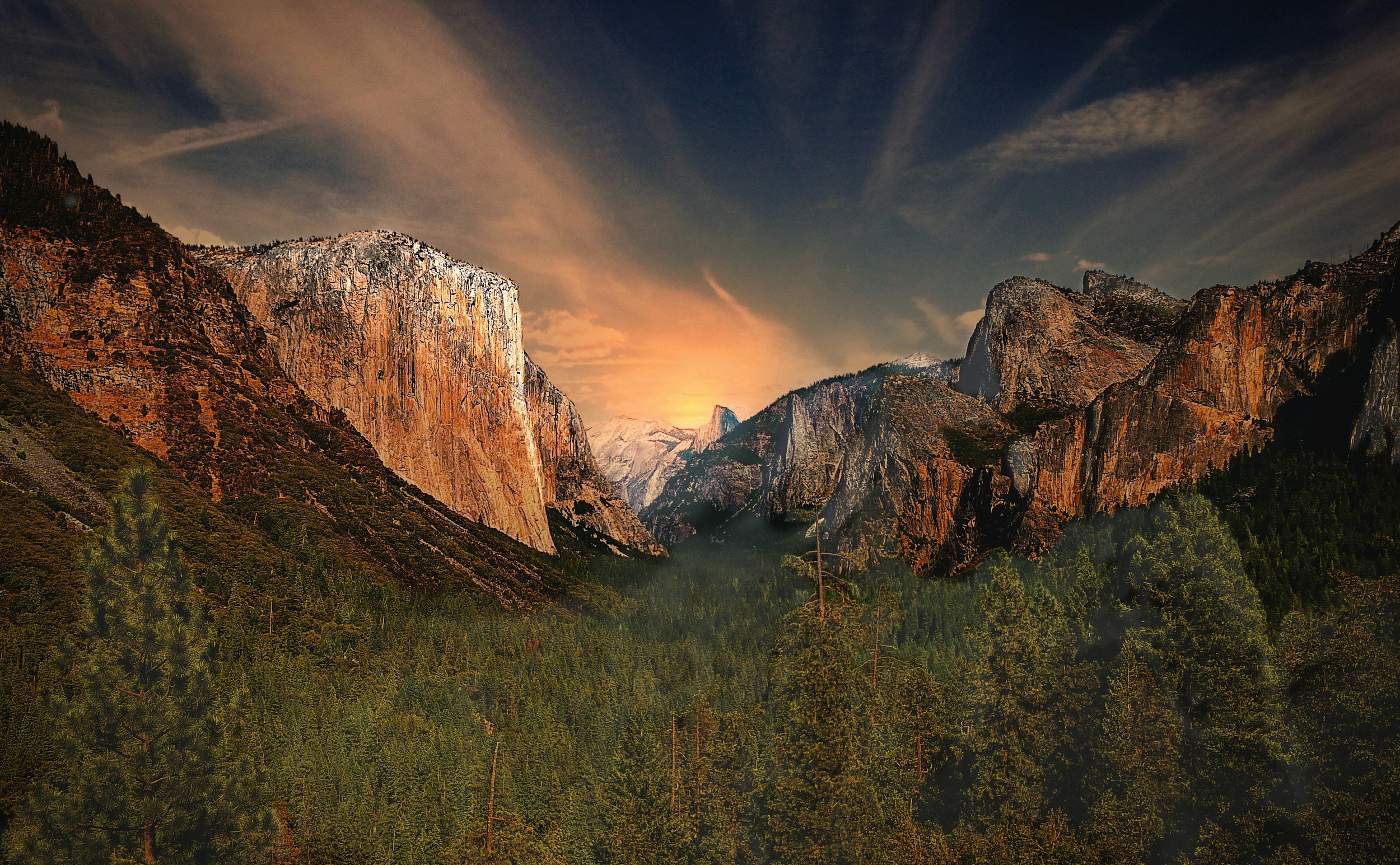
Image of El Capitan within Yosemite National Park. It’s borders were surveyed by Clarence King and crew working for the California Geological Survey in the 1860s.
A vocal abolitionist, he graduated in the midst of the Civil War in 1862, but rather than joining the war effort, his love of nature led him on a different path. King was fascinated with what he’d read about California and decided to see it for himself. On the trip, he befriended a family who invited King to accompany them on their wagon train west in return for taking care of the stock. Eventually, King made his way west to a steamship bound for San Francisco. On the streamer, he met William Henry Brewer of the California Geologic Survey. King offered to volunteer with the survey, and his career was launched.[2]
While working for the California Geologic Survey, King explored and mapped parts of the Sierra Nevada and Yosemite and also studied geologic formations in the area. His team surveyed the boundary of the Yosemite Valley as part of the Yosemite Valley Grant Act signed by President Lincoln in 1864, which gave California the funds to preserve the area for public use and recreation. It was during this period that King and his colleagues developed a system of rapid surveying by triangulation checked by astronomical locations and barometrical measurements that would later be the basis surveying in the 40th Parallel project.

O'Sullivan, T. H., photographer. (1872) Washakie Bad Lands, Wyoming. , 1872. [Photograph] Retrieved from the Library of Congress,.
King’s experiences with the California Geologic Survey planted the seeds for an even bigger project that had its basis in the widespread fear that California would take advantage of its massive wealth in natural resources and leave the Union. (Understandable, since the Civil War had just managed to preserve the country). The transcontinental railroads under construction were seen as one way of keeping California in the fold, but it clearly was not enough. King believed that Congress needed to authorize the making of a geological and topographical survey across the entire mountain range system at its widest point, and thus connecting the geology of the east with that of the west.

Image from the Report of the Geological Exploration of the Fortieth Parallel by Clarence King, 1878, Plate 1 “Heights of the \Vahsatch” By Julius Bien, chromolithographs after studies by Gilbert Manger, plates in black after photographs by T. H. O'Sullivan.
“It was with the object of impressing this view upon Congress and influencing their favorable action that in the winter of 1866-'7 King, then barely 25 years old and looking still more youthful, presented himself at Washington armed only with a few letters of introduction from his college professors and from friends whom he had made in California.” 1
King so impressed several powerful Congressmen that they championed his cause and on the second of March, 1867, Congress approved a bill whose last clause authorized the Secretary of War to direct an expedition to study all resources within the area 100 miles by 1000 miles – animal, vegetable and mineral, as well as to create maps and identify mineral deposits.

Map image from the Report of the Geological Exploration of the Fortieth Parallel by Clarence King, 1878, Map III “Analytical Geological Map of the Exploration of the Fortieth Parallel” Page 867
King was appointed Geologist in charge of the Geological Exploration of the Fortieth Parallel. The mission of the survey was to examine the geological features and natural resources across a band of land between the 105th and the 120th meridians along the 40th parallel. Additional natural scientists to the survey included three geologists, a botanist, and an ornithologist. This survey would be based in science, backed by accurate surveying. In order to document the survey, King hired Timothy O'Sullivan, a former photographer with Mathew Brady's Civil War photography corps.[3]

Image from the Report of the Geological Exploration of the Fortieth Parallel by Clarence King, 1878, Plate VII “Upper Valley of the Bear RIver, Uinta Range, Utah. By Julius Bien, chromolithographs after studies by Gilbert Manger, plates in black after photographs by T. H. O'Sullivan.
The photographer was key to communicating the natural beauty of the landscape – information that later helped convince the public to support the creation of additional national parks.
“The Fortieth Parallel Survey set up a base-camp in the Truckee Meadows, near present-day Reno, Nevada. Their first task was to make a 15,000 square mile map of the area between the California Sierra Nevada and the Shoshone mountain range 150 miles to the east. Though the survey did not make it to the 105th meridian, King and his men crossed the Humboldt Sink, the Carson Sink, and the Black Rock desert. They collected two thousand rock specimens, examined numerous mines, and set up 300 barometrical stations before ending the first season and returning to base camp.
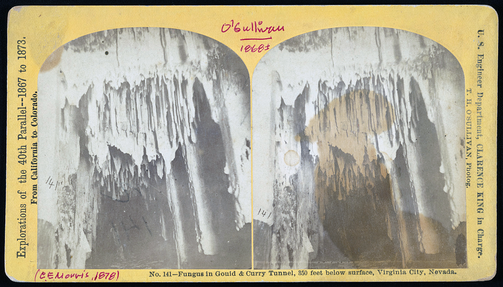
King, C., O'Sullivan, T. H., photographer. (1868) No. 141 - Fungus in Gould & Curry Tunnel, 850 feet below surface, Virginia City, Nevada / U.S. Engineer Department, Clarence King in charge, T.H. Sullivan, Photog. Nevada Virginia City, 1868. [United States: Publisher not identified] [Photograph] Retrieved from the Library of Congress.
While wintering in Virginia City, Clarence King and two other geologists explored and gathered data on Comstock mines, while photographer Timothy O'Sullivan took photographs from deep inside the Comstock mines, using magnesium flashes for illumination.
The Fortieth Parallel Survey's second season expanded the territory of the first season to cover all the Great Basin as far as Salt Lake. The U.S. Congress, pleased with the quality and amount of scientific information sent by the expedition, funded subsequent seasons until 1873, when General Andrew Atkinson Humphreys concluded the survey.

Longitudinal Profiles of Ranges on Fortieth Parallel Area, Diagram 1, from the Report of the Geological Exploration of the Fortieth Parallel by Clarence King, 1878,
Seven volumes of research were published during and after the Fortieth Parallel Survey, including The Mining Industry (1870), Microscopic Petrography (1876), Descriptive Geology (1877), and Systematic Geology (1878).” [3]
The USGS
To unify the four great surveys under one umbrella, Congress established the United States Geological Survey (USGS) in 1879, and President Hayes nominated Clarence King to be the first director. He was tasked with structuring the bureau and staffing it. In just two years, he felt he’d completed the job and stepped down to go into private business. He was succeeded by John Wesley Powell, the one-armed Civil War veteran and geologist who was the first person to run the Colorado River down the entire length of the Grand Canyon.
Clarence King was an adventurer, leader, scientist, surveyor, environmentalist, mountaineer and father. Thanks to his work, the vast resource wealth and natural beauty of the American West was shared with the public. More than 160 years ago, King surveyed the boundaries of Yosemite - and over this 4th of July weekend, more than 50,000 people are expected to enjoy this spectacular park.