Presidents and surveyors led the way
President’s Day has been a federal holiday since 1879 when it was instituted to memorialize the birthday of George Washington, born on February 22, 1732. By the 1970s, the holiday had evolved to commemorate all US Presidents[1].

Highsmith, C. M., photographer. Mount Rushmore, South Dakota. United States South Dakota Mount Rushmore, None. [Between 1980 and 2006] Retrieved from the Library of Congress,
Mt. Rushmore
In the 1920s, a historian for the state of South Dakota came up with the idea of creating a massive sculpture that featured heroes of the American West to increase tourism in the area. The idea was good, but the sculptor decided a different subject would work better on the site. With the help of federal funding, the sculpture named Shrine of Democracy was completed in 1941. It depicted the 60-foot tall heads of four US Presidents, representing the nation’s birth, growth, development and preservation: Washington, Jefferson, Roosevelt and Lincoln[2].
As surveyors know, three of these four men were surveyors, and the fourth, Teddy Roosevelt, was a cartographer.
Of the four, Thomas Jefferson’s surveying background had the greatest impact on the United States. He created the Public Land Survey System (PLSS), to measure and sell the massive amount of land acquired in the Louisiana Purchase. Originally established in 1785 by the Land Ordinance, the PLSS remains the primary legal definition of most property in the United States. The PLSS is still used in most states, except for the original thirteen states and a few states that were surveyed based on Spanish land grant boundaries[3].
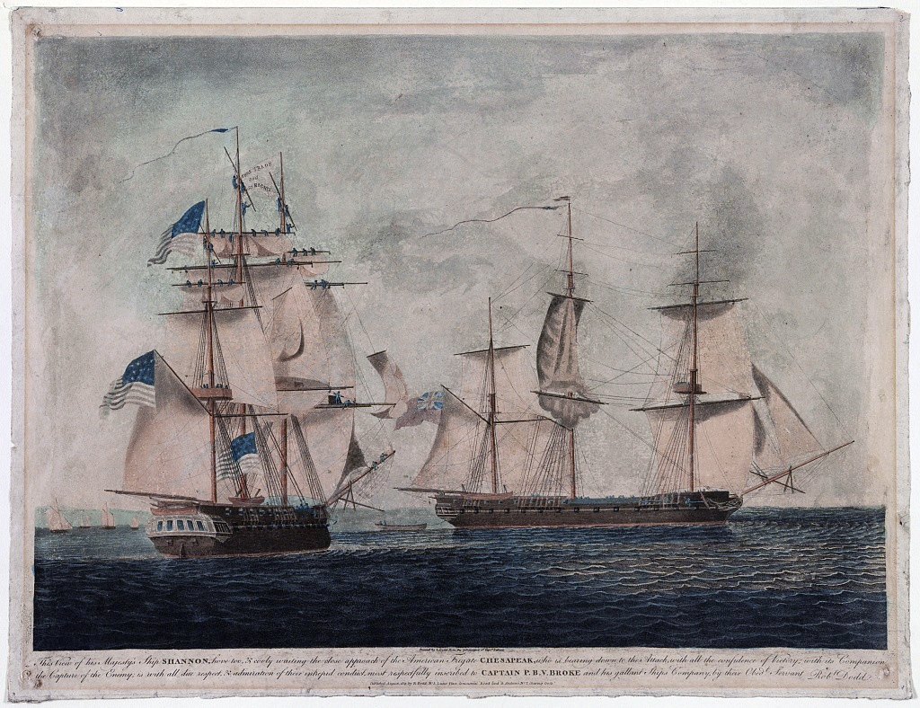
Dodd, R. (1813) This view of his majesty's ship Shannon, hove too, & cooly waiting the close approach of the American frigate Chesapeak, ... / painted by R. Dodd from the information of Captn. Falkinir. United States, 1813. [London: Published by R. Dodd, No. 3, Lucas Place, Commercial Road and G. Andrews, No. 7, Charing Cross, August] Retrieved from the Library of Congress.
But Jefferson’s lasting influence on surveying didn’t end there. He also ordered a number of expeditions to explore the west, including notable treks by Zebulon Pike, and of course, the epic Lewis & Clark expedition.
National Defense
During this time of westward exploration, Jefferson was also concerned about national defense. His time in office (1801-1809) overlapped with the rise of Napoleon (1804-1815). Jefferson was deeply concerned about becoming entangled in ongoing conflicts between Napoleonic France and England. In fact, both France and Great Britain were trying to control the commercial shipping of other nations by sanctions and seizures. Britain's fear of invasion by France and its critical need for maritime control led to increased instances of impressments of American seamen into the Royal Navy .
Additionally, it was clear that American coastal defenses were weak. Unfortunately, most of the Atlantic coast had not been surveyed and there were few accurate maps, so it was difficult to determine where defenses should be increased. With Jefferson’s backing, and the full support of the US Congress, “An act to provide for surveying the coasts of the United States” was signed by Jefferson on February 10, 1807. The bill declared a very specific objective — a survey to result in complete and accurate charts of the entire coast of the United States. Aside from encouraging commerce, the information from this survey could be useful in designating the maritime boundaries of the United States and so discourage "belligerent searches and seizures."[4]
Here's where it gets interesting – at that time, the instruments needed accurately measure and map the coastline were not available in the United States. Jefferson had chosen a Swiss mathematician and surveyor, Ferdinand R. Hassler to lead the project, so Hassler was sent to England to procure the instruments, many of which were built to his design. His visit to Britain was greatly extended by the War of 1812, so Hassler didn’t return to the US until 1815. The survey began in New York Harbor in 1817.
Science to the rescue
It turns out that Jefferson’s foresight resulted in not only better defenses, but better science.

F.R. Hassler, Superintendent of the U.S. Coast Survey. , . [No Date Recorded on Shelflist Card] Retrieved from the Library of Congress.
Hassler created the first geodetic survey in North America.
“Geodesy is the ancient science of the size and shape of the Earth and the determination of the exact locations of very specific points on the Earth's surface. Hassler's emerging geodetic network was the fruit of both brute-force bushwhacking up hill slopes and also advanced trigonometry, in about equal measures. Only with that well-defined geodetic skeleton, as it were, could Hassler and his staff then turn back to the coast of the Atlantic to chart the harbor entrances and reefs and treacherous shoals of such a supremely maritime nation as was the United States in that era.
Hassler and his staff worked outward in both directions from Long Island along the Atlantic coast, and then wherever American territorial shores were won or declared. Hassler had rivals and critics who demanded to know when the "Survey of the Coast" would be completed. He eventually prevailed with the response that "Never" was an appropriate answer. Every permanent scientific agency in the government is descended from Hassler's persistence.”
Hassler was pretty close to being right. This work still continues to this day, using modern technology, including numerous types of remote sensing from multibeam sonars, lidar and satellite-derived bathymetry. The goal is that by 2030, a comprehensive map of the ocean floor within the U.S. Exclusive Economic Zone will be complete.
Thomas Jefferson, surveyor, scientist and president.
Looking back over the history of hydrography here in the United States it is easy to be impressed by how far we have come. President Thomas Jefferson had big plans for the Survey of the Coast on February 10, 1807, when he signed it into being. Ferdinand Hassler, the first director of the Survey of the Coast, introduced precise geodetic surveying methods never before used in North America.
At the time, no one could have predicted that The Survey of the Coast would become the scientific juggernaut it is today. In 1878, it became the U.S. Coast and Geodetic Survey, and in 1965 it became a component of the Environmental Sciences Services Administration. Then in 1970, it was reorganized as the National Oceanic and Atmospheric Administration (NOAA). No doubt it would have been a point of pride with Jefferson to have played a part in the establishment of what is considered today the oldest scientific agency in the U.S. government[5].
Berntsen supports federal agencies
Berntsen is proud to support the NOAA and many other federal agencies.

Back in 2002, during the celebration of the bicentennial of the Lewis & Clark expedition, a Berntsen marker was placed on the west lawn of Monticello, Jefferson’s home.
NOAA’s National Geodetic Survey and Global Positioning System (GPS) manufacturers Leica, Thales, Topcon, and Trimble positioned the marker to an accuracy of one-half inch relative to the National Spatial Reference System. The preliminary coordinates are:
NAD 83 (1993)
38-00-35.57269 N
78-27-12.91469 W
NAVD 88
Elevation – 263-97 m (866.0 ft.)
Berntsen is in it for the long haul. For more than 50 years, we’ve provided quality products that help surveyors - from single-shingle entrepreneurs to surveying firms to state and federal agencies. Contact us to see how we can help you leave your mark.
Footnotes:
[1]https://en.wikipedia.org/wiki/Presidents%27_Day
[2] https://en.wikipedia.org/wiki/Mount_Rushmore
[3] https://www.geographyrealm.com/what-is-the-public-land-survey-and-why-do-we-still-use-it
[4] https://www.monticello.org/research-education/thomas-jefferson-encyclopedia/survey-of-the-coast/
[5] Gaye Wilson, 2007. Originally published as "Jefferson Authorizes the Survey of the Coast," in Monticello Newsletter 18 (Fall 2007).
References:
https://www.xyht.com/hydromarine/world-hydrography-day/
https://www.monticello.org/research-education/thomas-jefferson-encyclopedia/surveying/